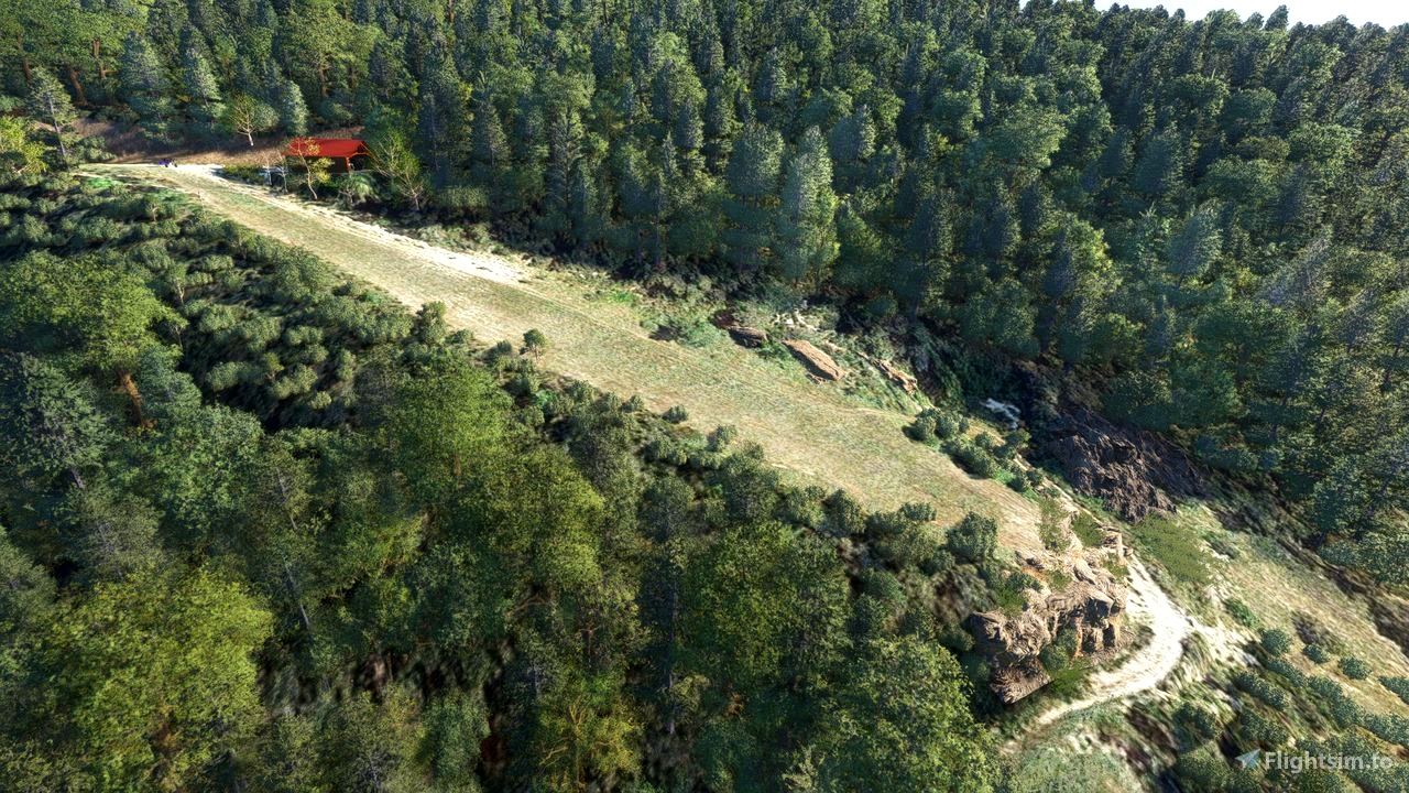
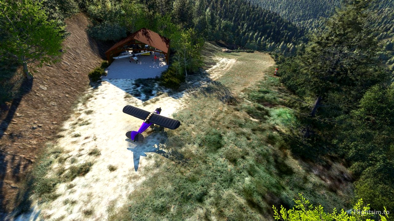
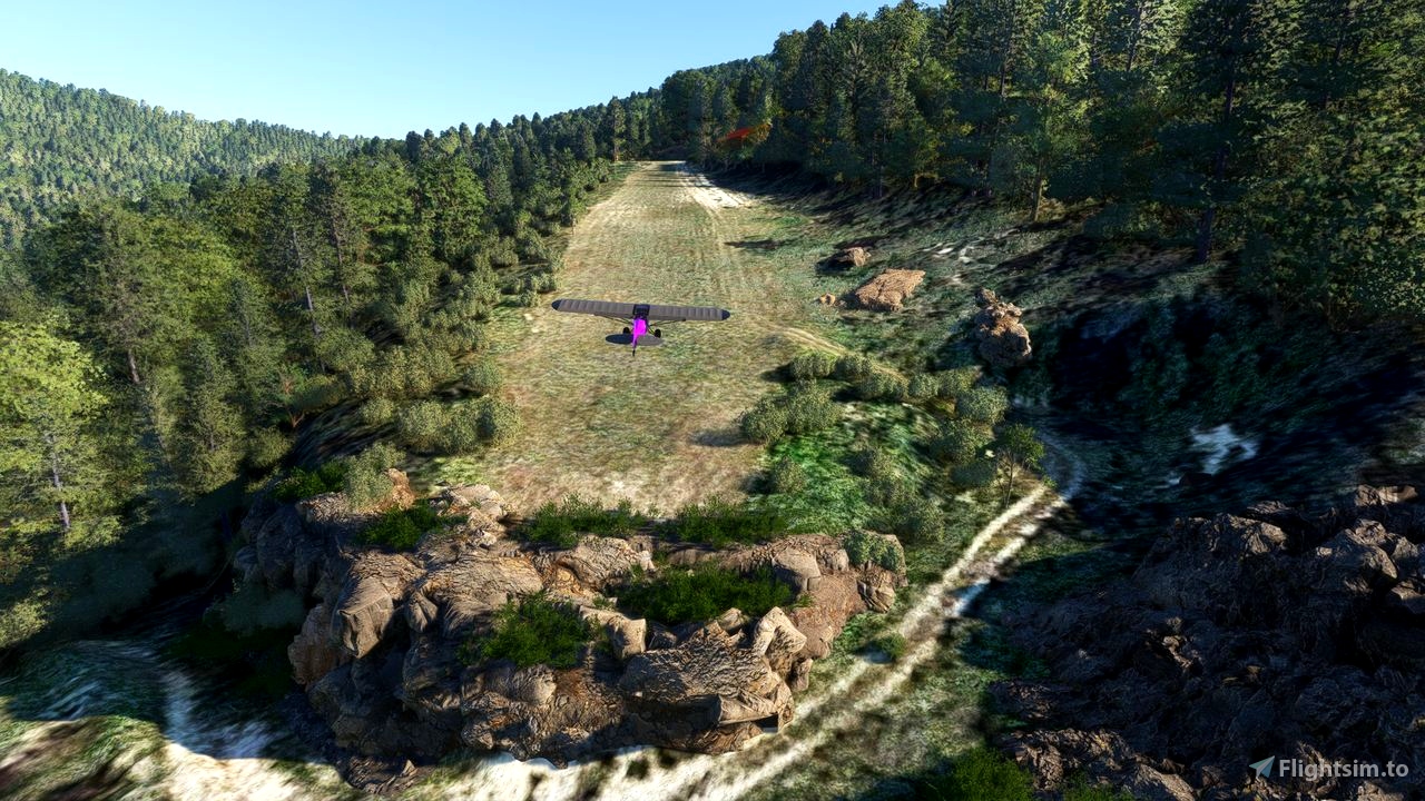
Private airfield nestled in a combe in the commune of Bellegarde-en-Diois in the southern Vercors, more precisely in the Haut Diois, Drome department (26), France.
This altisurface is particularly technical in strong to moderate winds!
ICAO MSFS: F2622 (in place of the generic LF53 Die airport)
LAT: 44 33 13 N LONG: 005 26 18 E ALT: 3378ft
QFU:06-24 - natural ground - 200x20m concave - 19% slope
Landing in 06 - Take-off in 24
Do not fly over farms.
Nearby airport Dist. Heading
-------------------------------------------------------------------------------
[LFJE] LA-MOTTE-CHALANCON 3.6Nm ( 6.7Km) 205°
[LFNJ] ASPRES-SUR-BUECH 12.9Nm (24.0Km) 99°
[LFTM] SERRES-LA-BATIE 13.7Nm (25.3Km) 115°
BASULM sheet: https://map.aerobreak.com/data/ficheffplum/LF2622.pdf
Dependencies:
tsr-windy-things
ethnicfs-vegetation-library
totof-aircraft-library V4
totofteam-france-totofobjet v5
ethnicfs-vegetation-library
Thanks to them for their work and their contributions to the simmer community!
*** This scene is optimized for Google Map tiles (AddOn Map Enhancement) ***
Installation: Unzip the folder "dr-airport-lf2622-bellegarde" into your COMMUNITY folder.
Happy landing ...
A real landing and take-off video by Alpha Lima
*************************************************************************************************************
Altisurface privée nichée dans une combe sur la commune de Bellegarde-en-Diois dans le sud du Vercors plus précisement dans le Haut Diois, département de la Drome (26) France.
Cette altisurface est particulèrement technique par vent fort, voir modéré!
ICAO MSFS: F2622 (en lieu et place de LF53 Aéroport de Die générique)
LAT: 44 33 13 N LONG: 005 26 18 E ALT: 3378ft
QFU:06-24 - sol naturel - 200x20m concave - Pente 19%
Atterissage en 06 - Décollage en 24
Ne pas survoler les fermes.
Bon attero ...

 fugazi01


4 months ago
Fredox
5 months ago
5 months ago
fugazi01
con7inuum
5 months ago
5 months ago
fugazi01
fStopper
5 months ago
5 months ago
fugazi01
PAPYDANIEL66