

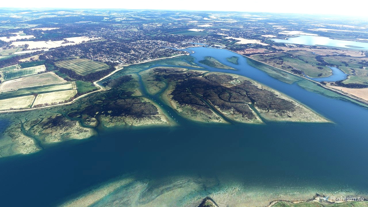
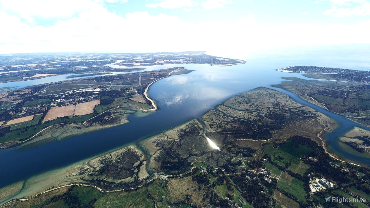
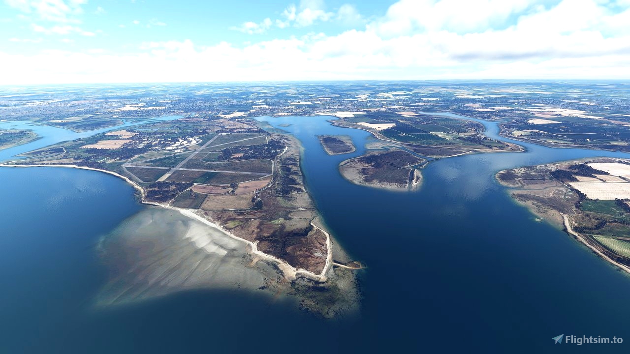
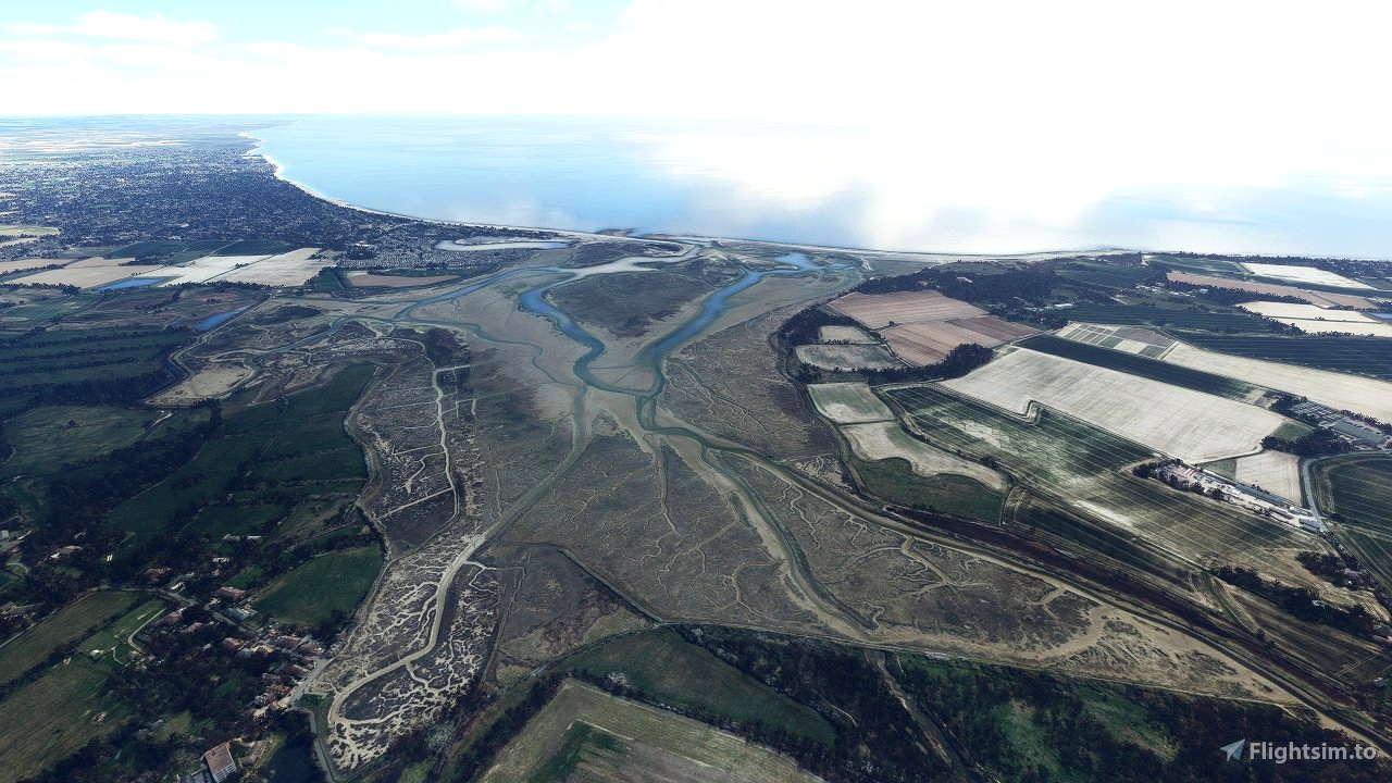
This one wasn't quite finished and just when I was putting the finishing touches to it I lost all the SDK project files due to a crash in Microsoft Flight Simulator. It was 95% complete so I have decided to release as is in the hope it provides some improvement over the default coastlines in the area. Please note there may be a few trees or rough edges here and there that I didn't get chance to remove but most is complete.
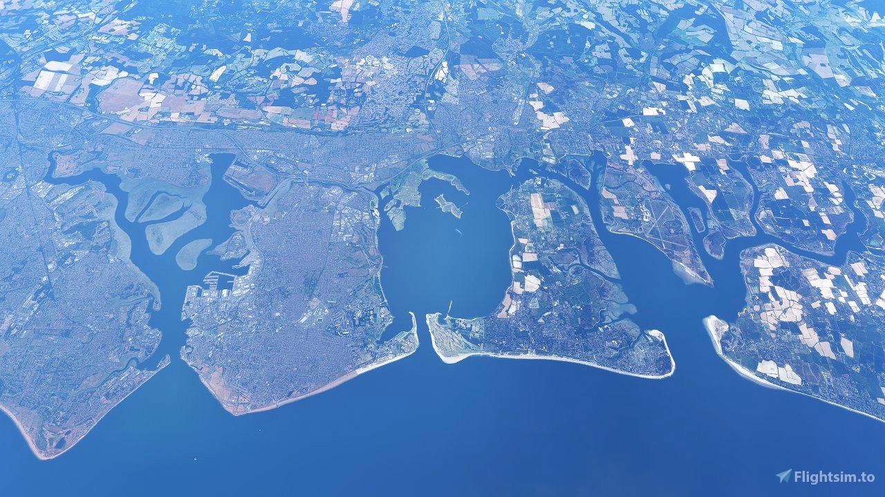
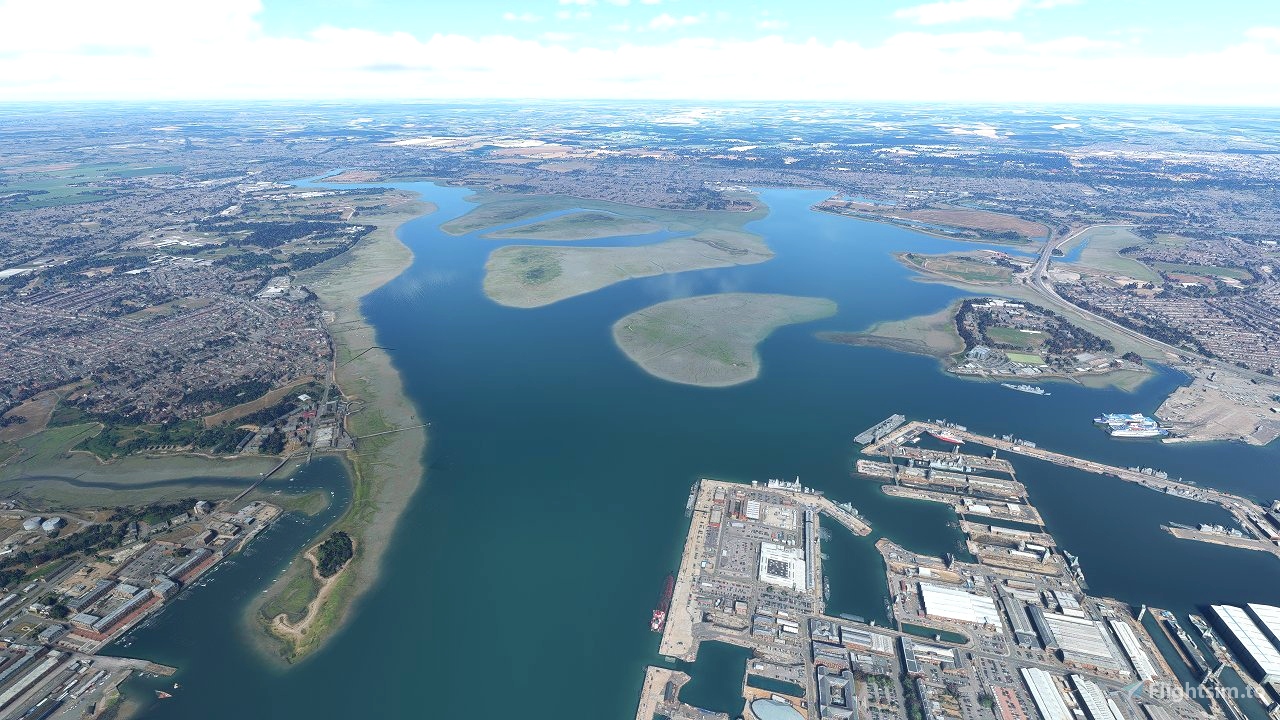
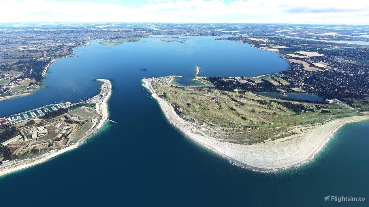
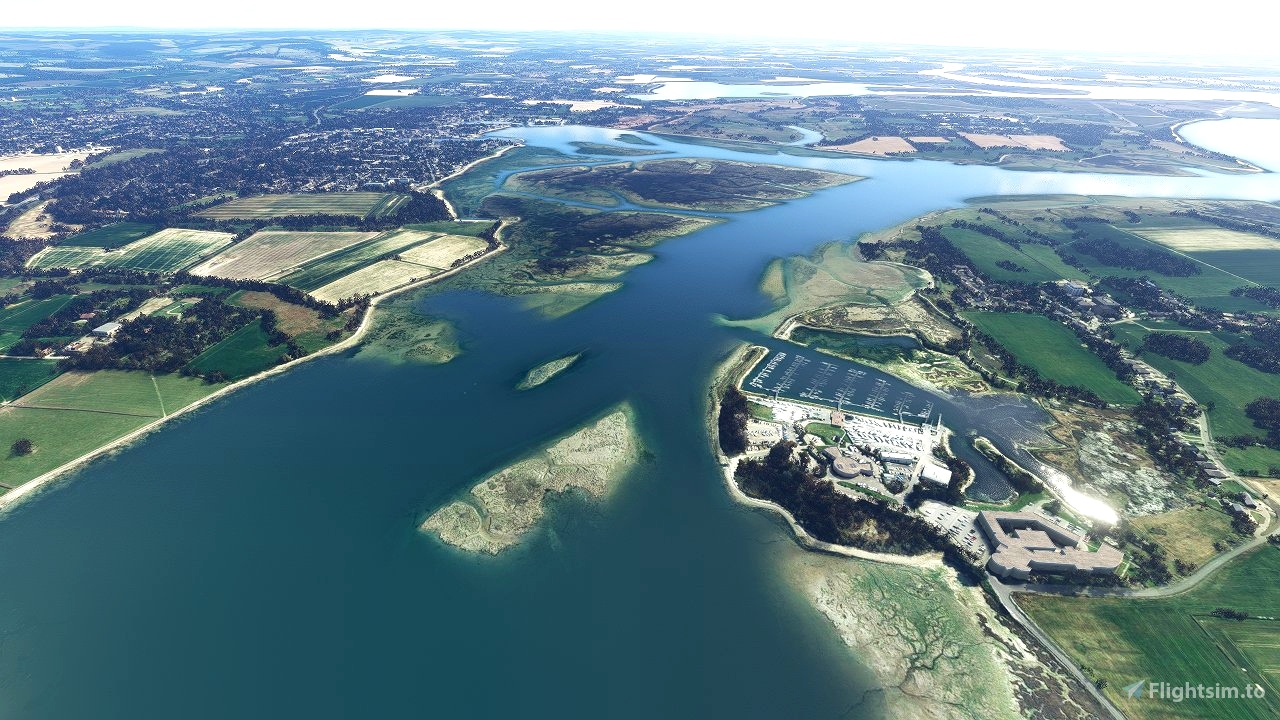
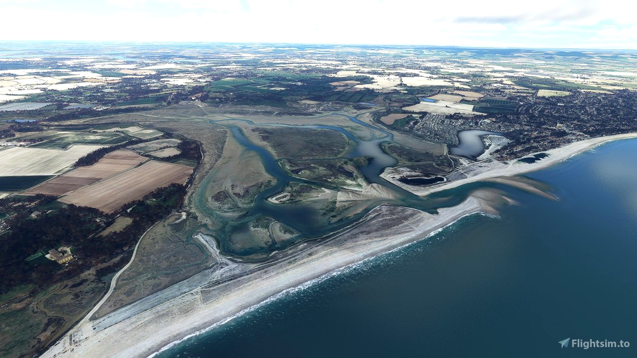
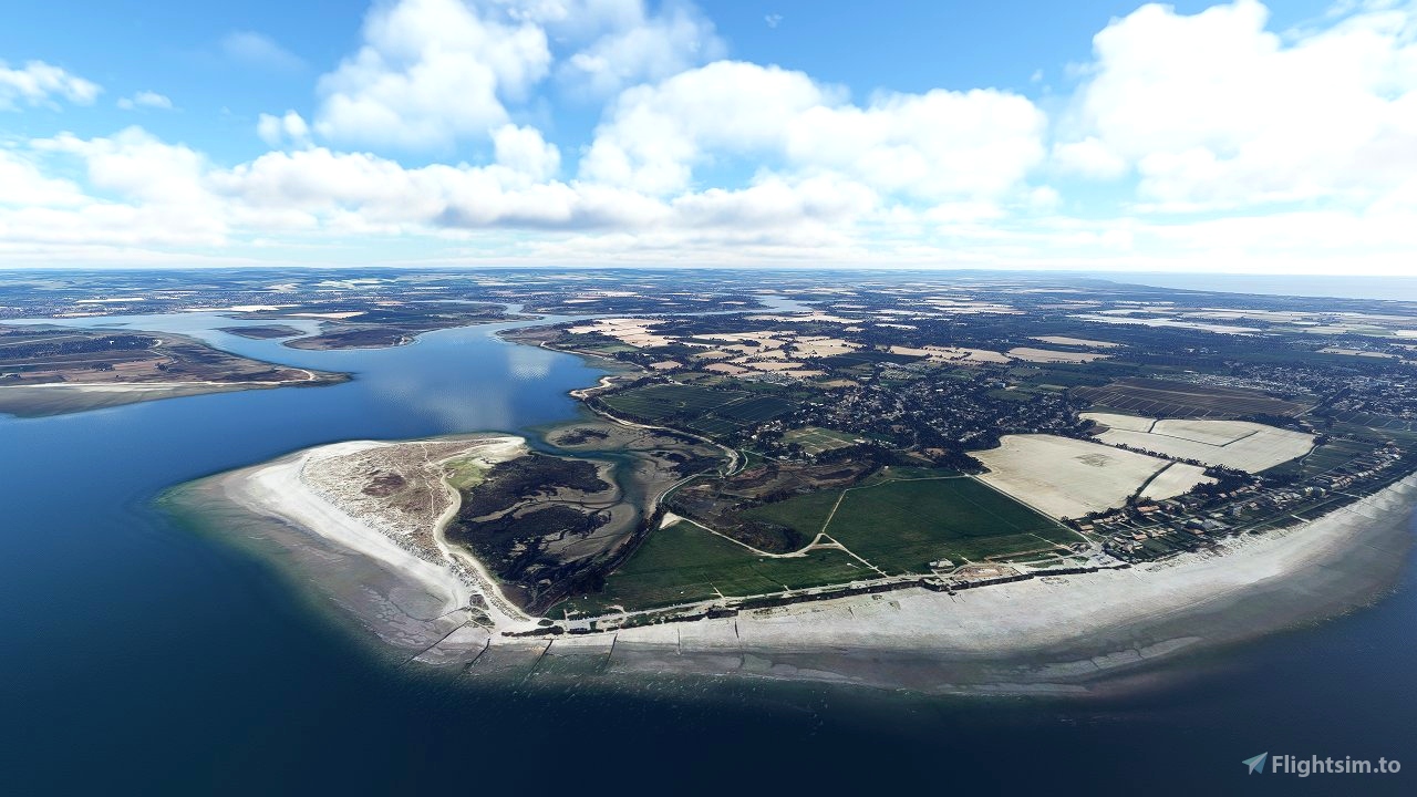
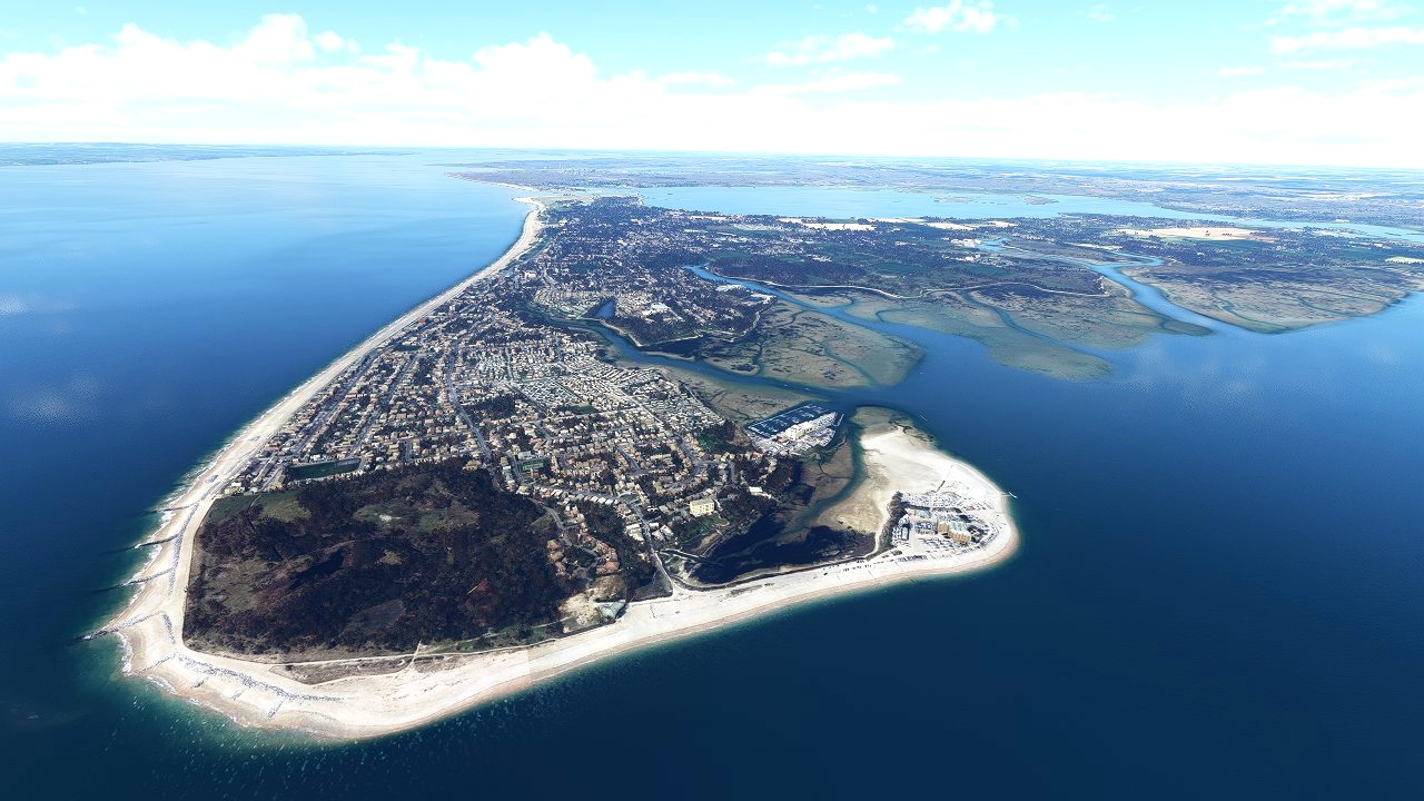
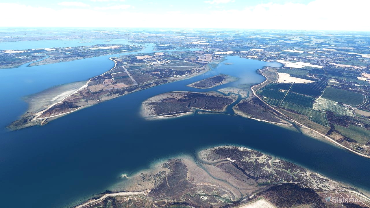
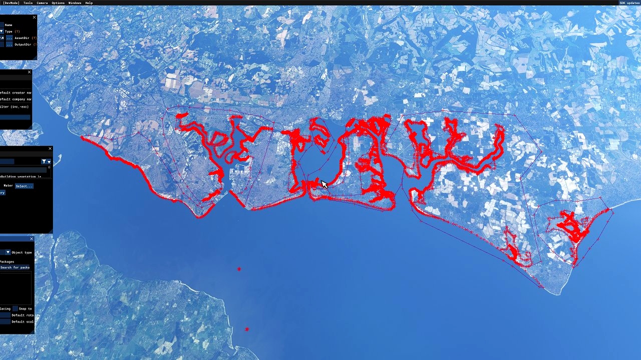
This one coveres the Portsmouth area from Lee-on-the-Solent to Aldwick Beach revealing the sandbanks and marshes where the satalite imagery allows.
For instalation extract the folder "mgk07-portsmouth" into your MSFS community folder.
Check out my other sandbank mods here: https://flightsim.to/profile/mgk07/uploads
Happy Flying,
Mark.

 mgk07
mgk07 


Really good work, I fly out of of Solent a lot so great to have this. However, there's an issue - if you look at the area so the west of EGHF airfield, it's all at low tide whereas everything around it is more like high tide. Also some random trees in the water. Can you fix that?
1 years ago
Mattadee
This is an extremely nice addon that makes the whole area much more interesting and authentic (even if its not 100% correct as discussed before). I love these mud flats - very beautiful. Well done! So good :0)
2 years ago
Floyd
Great addon for local GA flying, thanks for making this!
2 years ago
Mattadee
Looks really good at 5000' but at ground level or above you can clearly see that these are above water height and they have trees!!!
In Portsmouth Harbour for instance none of these sand banks and silt deposits are above water real World but instead a fathom or two submerged with the exception of Rat Island. It's a pity as I do a lot of low level flying in this area so cannot use this for realism.
Would they be better as water masks? Is that easy to do?
2 years ago
They would definitely be better as watermasks yes but it is currently not possible to create your own watermasks within the sim (not properly anyway) so this is kind of a halfway house at the moment until ASOBO allow this feature ( if at all!).
Sometimes its hard to tell if the uncovered area is above water level or just below with really clear and shallow water above it unless you know the area well plus as I said in the description I didn't get chance to finish this properly so this one is "as is" unfortunately.
2 years ago
mgk07
WillFly
Thanks for continuing to release these. Are Devon and Dorset on your To Do list?
2 years ago
Thanks it is on the to do list yes so will hopefully get round to it soon 👍
2 years ago
mgk07
KevinBrook
One area that really needs doing is the Severn Estuary and Bristol Channel. I like your work and your sandbanks covering S Wales help. Thanks for all your efforts so far.
2 years ago
I actually thought the same and went to work on that area a few weeks back but unfortunately the satellite imagery is either taken at full tide or is stitched together images of different tide stages and generic textures so there was literally nothing good to reveal unfortunately.
2 years ago
mgk07
cianpars
fantastic keep it coming
2 years ago
flightsimcockpit