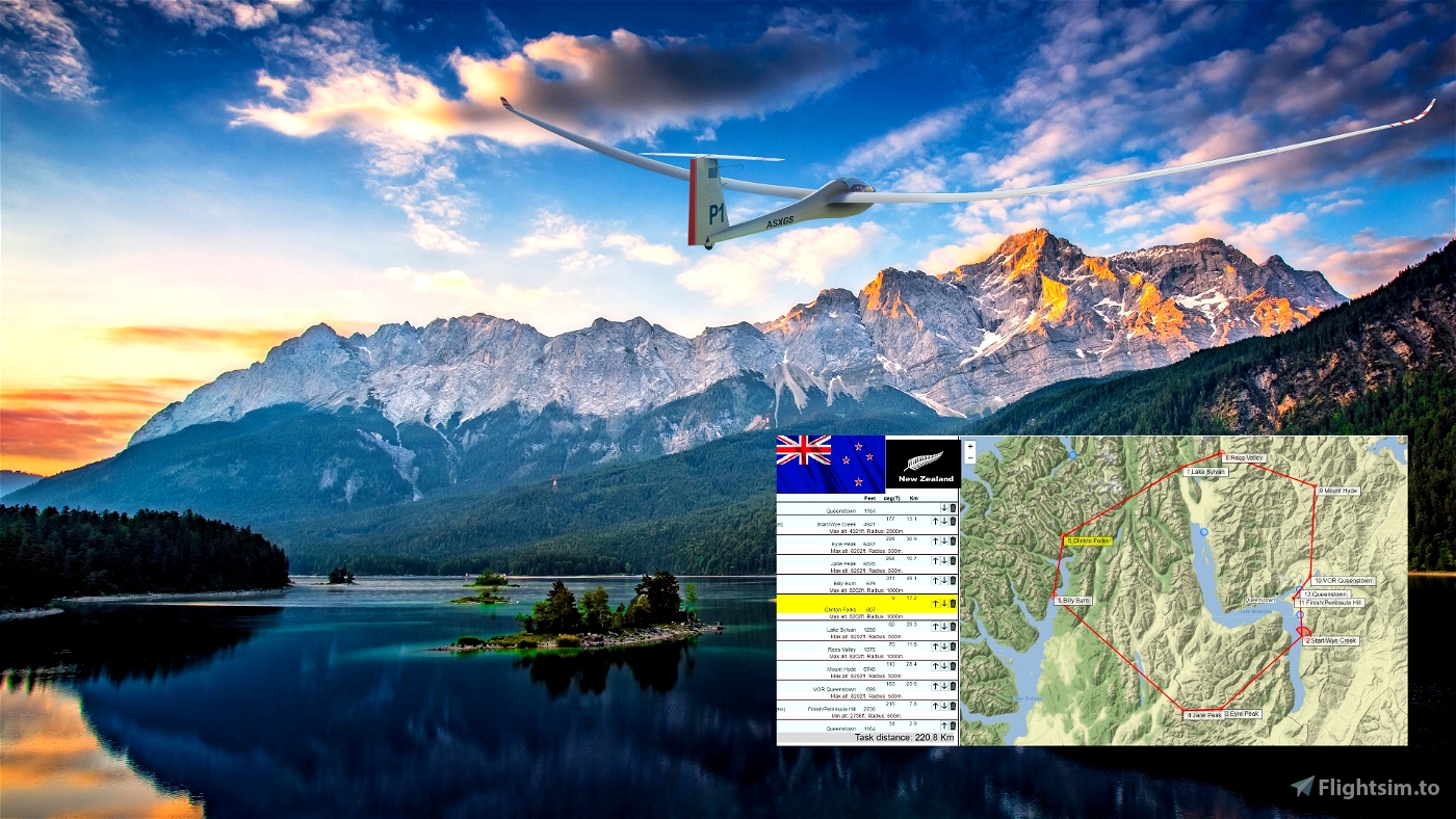
Queenstown 221 New Zealand. .
Distance: 221 km. Length:1.5 - 2h. ..
Departure: Queenstown - NZQN 3606 feet 05
Destination: Queenstown Airport - NZQT 1183 feet 27
Distance: 321 km
Length: 1.5 - 2 h
Difficulty: Medium
Use and look to GPS to validate all crossing points (notification when done).
Watch your GPS .
Then adjust the GPS on the NZQN tab .
Use your catapult to take off. Pull on the yellow handle.
Or use your engine to take off.
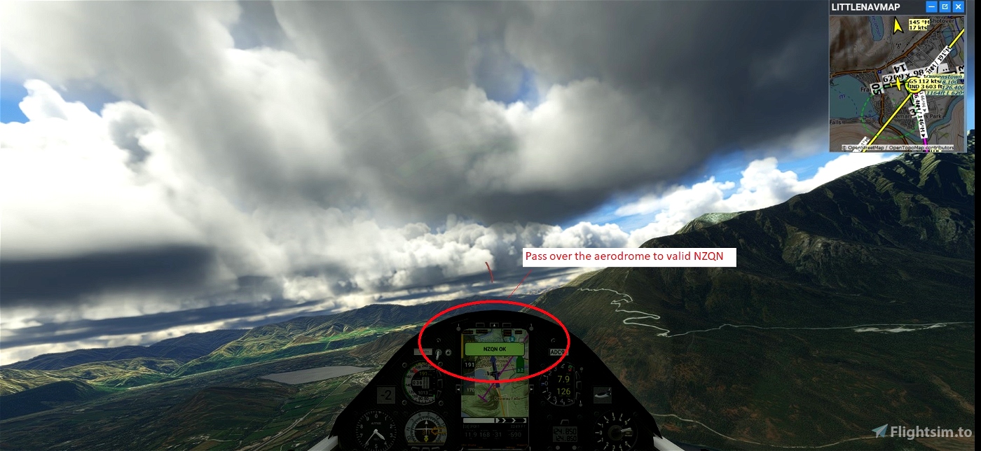
Pass over the aerodrome to valid NZQN
When you have reached 2500 feet, turn right to unhook the cable and pass over the aerodrome.
Make sure that you have validated the crossing point above the aerodrome.
Use and look to GPS to validate all crossing points (notification when done).
Start your engine to reach 5500 feet.
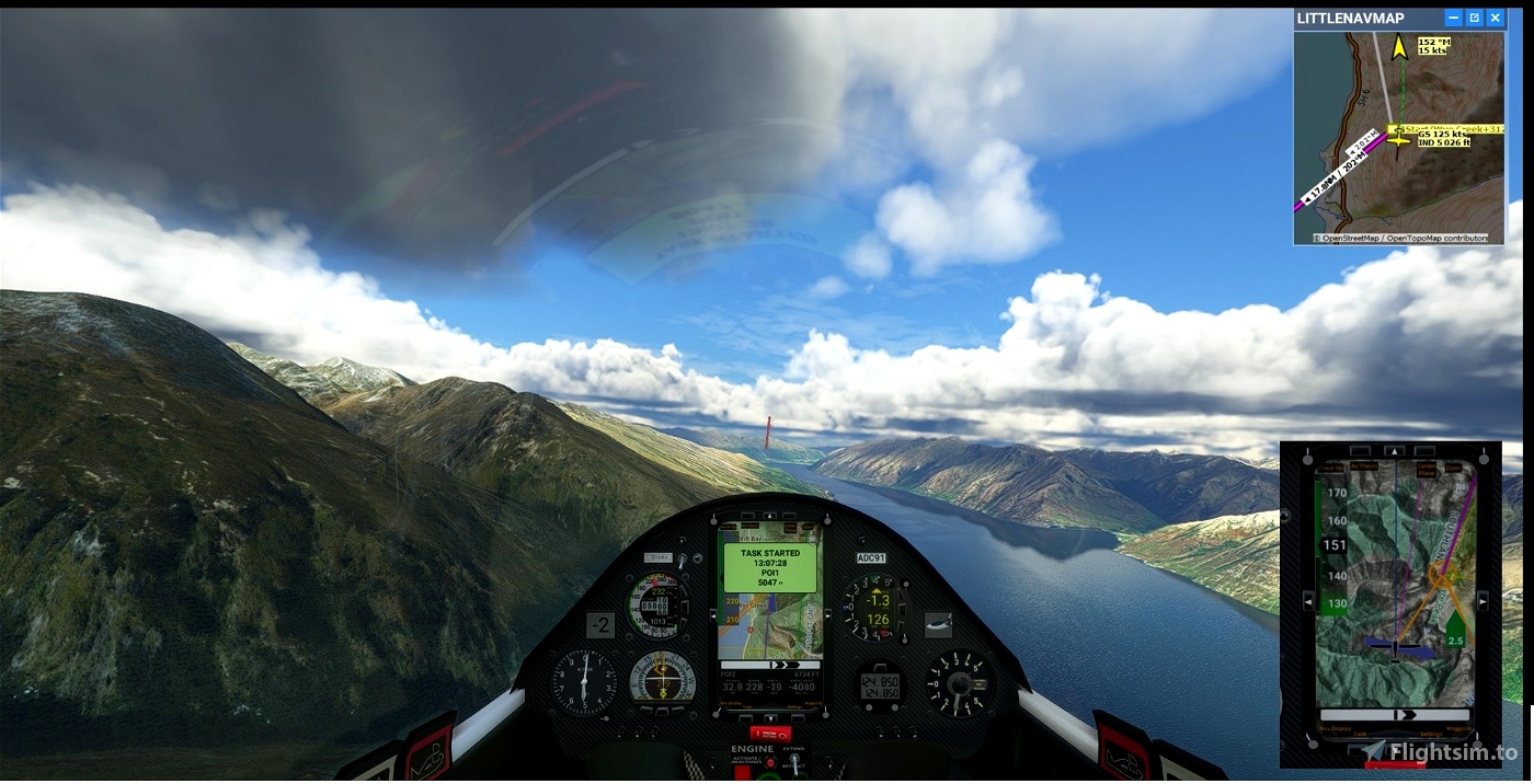
Maximum height to pass the POI1 start line.
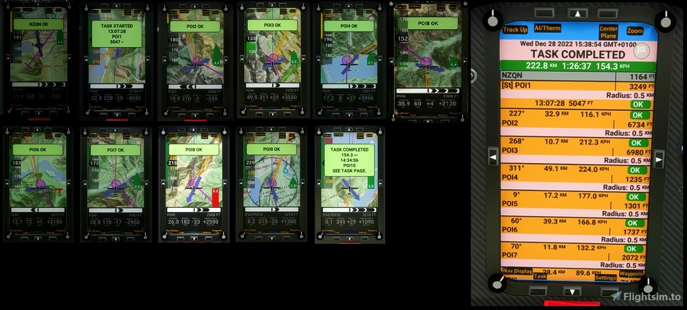
POI1: Starting line.Wye Creek .Elevation 4783. Altidude Maxi 5 000 feet for the best challenge
POI2: Eyre Peak. Elevation 6437 feet . Altidude Maxi 8 000
POI3: Jane Peak. Elevation 6535 feet . Altidude Maxi 8 000
POI4: Billy Burn. Elevation 680 feet . Altidude Maxi 8 000
POI5: Clinton Forks. Elevation 807 feet . Altidude Maxi 8 000
POI6: Lake Sylvan. Elevation 1250 feet . Altidude Maxi 8 000
POI7: Rees Valley. Elevation 1575 feet . Altidude Maxi 8 000
POI8: Mount Hyde. Elevation 6745 feet . Altidude Maxi 8 000
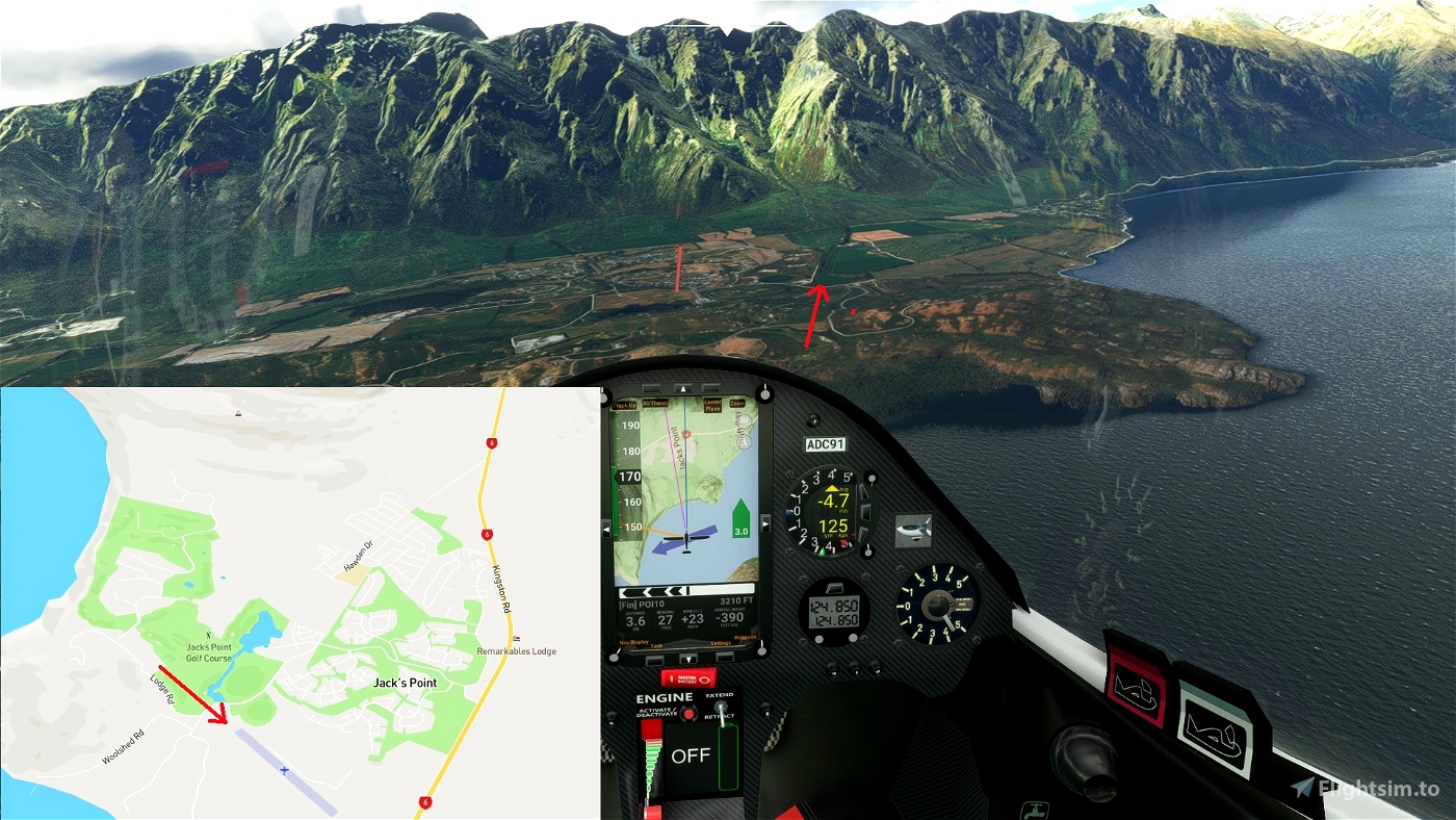
POI9: VOR Queenstown. Elevation 700 feet . Altidude Maxi 4 000
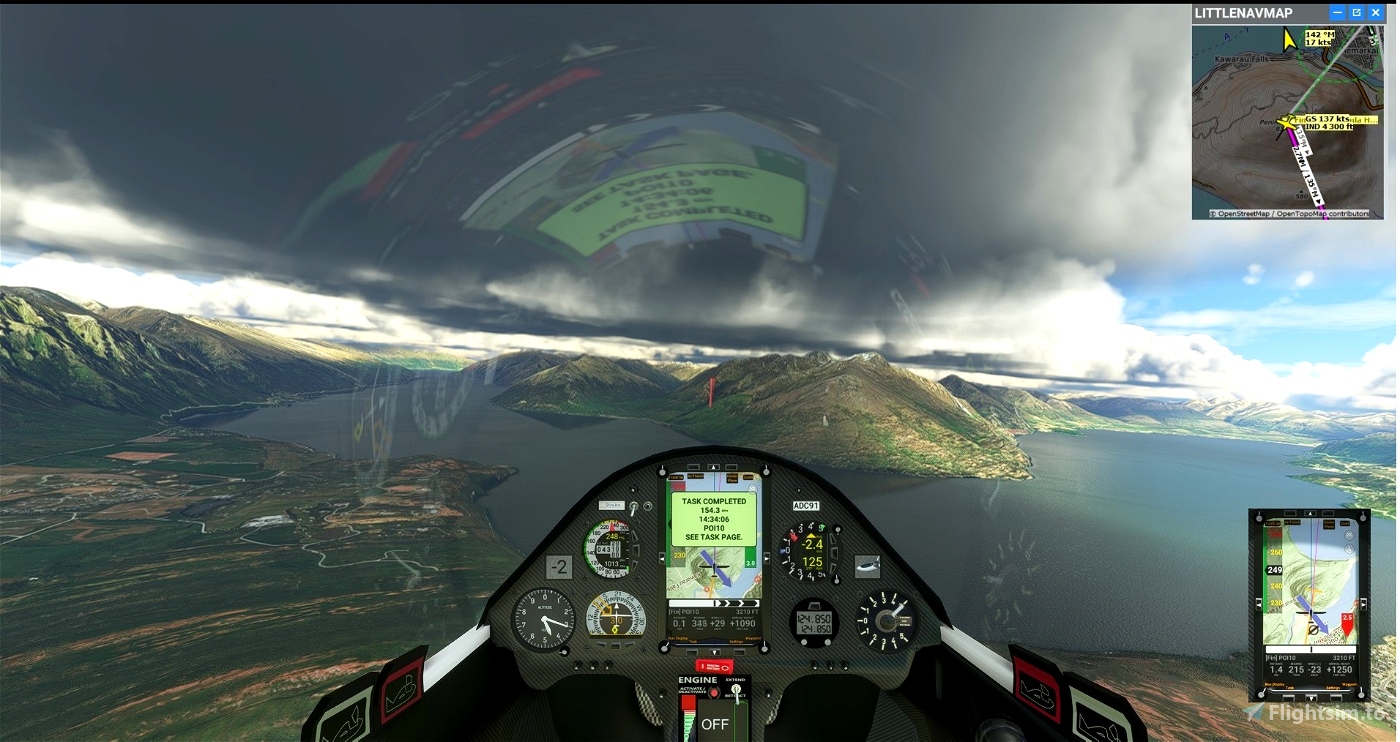
POI10:Finish line. Peninsula Hill. Elevation 2736 feet . Altidude Maxi 8 000
Landing at Antichan - NZQT 1183 feet
Turn off your main battery when you have landed
mode
AS 33 Me » Microsoft Flight Simulator
autor map and weather : GeorgOrtner
https://discord.com/invite/8TaW8QjH
https://discord.com/invite/8TaW8QjH
https://www.twitch.tv/videos/1534299342
https://www.youtube.com/GeorgOrtner

 ADCKillerman


Thank you!
1 years ago
Ginete
Well ... I managed to complete the course (all 2 hours of it!!) but, sadly, I get a freeze on landing so can't complete the mission. As soon as the glider touches down/slows I get a fuel error and all the avionics start flashing. It's a great mission - over beautiful terrain ... just a shame it all goes wrong right at the very end!
1 years ago
thank you for your feedback.
Normally bush trip is not necessarily adapted for the flight in glider.
I made a modification in the mission.
I am delighted that it has more you
1 years ago
ADCKillerman
AdamskiNZ